Columbia River Spring cruises through the Cascade Range: A Geographic and Seasonal Report
Columbia River spring cruises through the Cascade Range follow an approximately 80-mile corridor where the river cuts between Oregon and Washington. The journey is defined by basalt cliffs, waterfalls, forested slopes, snow-covered peaks, orchards, and historic communities, with the Columbia River Gorge serving as the central geographic feature. Spring departures generally emphasize changing water levels, high-flow tributaries, early wildflowers, and the transition from the wetter lower river toward drier inland landscapes. 3
Geographic setting of the Cascade Range route
The Columbia River flows through the Cascade Range before reaching the Pacific, creating the distinctive passage known as the Columbia River Gorge. The Gorge National Scenic Area protects approximately 293,000 acres of river, forest, cliffs, waterfalls, and cultural landscapes along the Oregon-Washington border. For cruise passengers, the route is experienced as a gradual sequence of narrow cliff sections, wider valleys, and open river views rather than as a single continuous canyon. 4 11
Geology is a visible part of the itinerary. The Gorge was shaped by volcanic forces and by the Missoula Floods more than 13,000 years ago, leaving basalt formations, steep walls, and layered valley terrain. Lindblad Expeditions describes Beacon Rock as an 848-foot basalt monolith rising directly from the Columbia River, while its itineraries also identify Multnomah Falls and Palouse Falls as major natural landmarks. 1 2
Spring scenery and seasonal timing
Spring changes the visual character of the Gorge from the conditions commonly associated with autumn wine-country cruises. Snow may remain on higher Cascade elevations, while lower slopes develop green vegetation and early blossoms. Around Wenatchee, early flowers can appear from late March through early April, peak arrowleaf balsamroot generally occurs from mid-April through early May, and higher-elevation lupine may continue into late May. Actual timing depends on temperature, snowpack, and late-season weather. 3
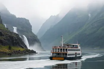
Waterfalls and tributaries can appear especially active during spring, although conditions vary by departure date and local precipitation. Multnomah Falls drops approximately 620 feet in two main tiers and is among the most recognizable Gorge attractions. Spring visibility is not guaranteed: rain, wind, cloud cover, and changing river conditions may alter views from the ship or affect shore access. 6 7
- Typical visual features include snowy peaks, green slopes, waterfalls, orchards, and high-flow streams.
- Wildflower timing varies with elevation and temperature.
- Cloud and rain can produce strong scenery while reducing long-distance mountain visibility.
Common cruise routing and river landmarks
Many Columbia itineraries begin or end in Portland and continue east through locations such as Hood River, The Dalles, and the Columbia River Gorge. Longer Columbia and Snake River routes may proceed toward Richland and Clarkston, Washington, with some itineraries extending into Hells Canyon. The route combines scenic cruising with land excursions, so a destination shown on an itinerary may require a motorcoach journey beyond the immediate riverfront. 8 9
Bonneville Lock and Dam is a major sightseeing landmark in the Gorge. The facility includes navigation locks, fish passage infrastructure, and visitor areas on both sides of the river. Farther east, the landscape becomes progressively drier, with rolling hills, agricultural areas, and wine-country communities replacing the denser lower-river vegetation. This geographic shift is one of the clearest features of an eastbound voyage. 5 9
| Route area | Common characteristics |
|---|---|
| Portland and lower Columbia | Urban access, coastal influence, and historic river connections |
| Columbia River Gorge | Basalt cliffs, waterfalls, locks, forests, and Cascade scenery |
| Hood River and The Dalles | Orchards, vineyards, agricultural valleys, and historic communities |
| Eastern Columbia and lower Snake | Drier hills, agricultural landscapes, locks, and access toward Clarkston |
Shore excursions and cultural interpretation
Shore programs commonly combine natural sites with regional history, food, wine, museums, and outdoor activities. Documented itineraries include visits to wineries and tasting rooms, downtown Walla Walla, Beacon Rock, Multnomah Falls, the Columbia Gorge Museum, and sites associated with the Lewis and Clark expedition. Some programs also offer kayaking, hiking, Zodiac exploration, or other active outings, but the availability and difficulty of each activity depend on the operator and departure date. 1 10
Astoria and Cape Disappointment connect the inland river journey with the Pacific coast and the history of the Corps of Discovery. Fort Clatsop, where Lewis and Clark spent the winter of 1805 to 1806, is another commonly referenced historical site. Native American history and cultural traditions are also included in some onboard and shoreside programming. These subjects are presented across multiple jurisdictions, so interpretation and access can differ among communities, agencies, and tribal lands. 1 9
Ships, locks, and operational limitations
Columbia and Snake River vessels are shaped by navigation infrastructure as well as passenger demand. A route from the lower Columbia toward Lewiston and Clarkston passes through eight navigation locks, and lock dimensions, bridge clearances, and dock conditions constrain vessel length, width, and height. Ships on this route are therefore generally smaller than many European river vessels. These engineering limitations influence schedules, port calls, and the way passengers reach shore. 9
Landing arrangements can vary by town and date. Cruise ships generally use gangways and docks rather than tenders, but two vessels may occasionally share a berth, requiring passengers to cross another ship. Some docks are close to town centers, while others involve slopes, uneven surfaces, limited transportation, or a motorcoach transfer. These practical factors are important for travelers assessing mobility, excursion independence, or the amount of walking involved. 9
Spring weather and preparation considerations
Spring weather in the Columbia River Gorge can change quickly, with cool mornings, rain, wind, and occasional sunny periods. The National Weather Service provides climate and forecast resources for the Portland and Gorge region, but conditions at the river, on exposed overlooks, and at higher elevations may differ. Layered clothing, waterproof outerwear, and footwear suitable for wet paths are practical considerations, particularly when excursions include waterfalls, trails, or open viewpoints. 7
Access is also subject to regulatory and environmental conditions. The Gorge crosses federal, state, tribal, and local jurisdictions, and excursion availability can change because of weather, maintenance, seasonal restrictions, river operations, or site capacity. A cruise itinerary should therefore be understood as a planned sequence rather than a guarantee that every overlook, trail, landing, or attraction will be accessible on a particular day. 4 7
- Check the stated walking distance and surface conditions for each excursion.
- Expect weather changes between the river, valley floors, and elevated viewpoints.
- Verify current landing points and transportation arrangements with the operating line.
- Distinguish between scenery visible from the ship and attractions requiring a shore transfer.
Sources
- Lindblad Expeditions, Columbia and Snake Rivers: Food, Wine and History
- Lindblad Expeditions, Columbia River: Harvests, History and Landscapes of the Pacific Northwest
- Wiley’s Boat Rides, Wenatchee Spring Wildflower Season and Columbia River Cruise
- Columbia River Gorge Commission, Our Region
- U.S. Army Corps of Engineers, Bonneville Lock and Dam
- U.S. Forest Service, Multnomah Falls
- National Weather Service, Portland Climate Resources
- Plan Your River Cruise, Columbia and Snake River Cruises
- Cruise Ports, Columbia and Snake River Cruise Ports
- Travel Oregon, Columbia River Gorge
- Encyclopaedia Britannica, Columbia River
Authored by MyTrendSpot team